


Caernarfon
CAERNARVON: Military aerodrome later a civil aerodrome
Known as RAF LLANDWROG in WW2 and now spelt CAERNARFON
(Aka more recently as CAERNARFON AIRPARK)
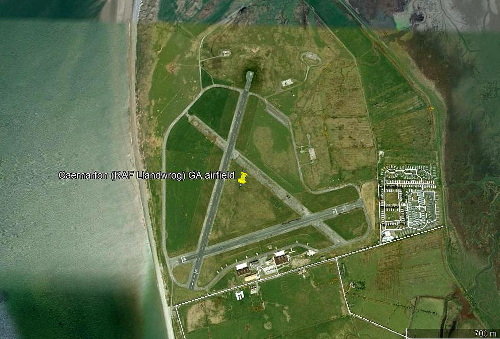
Note: This picture (2018) was obtained from Google Earth ©
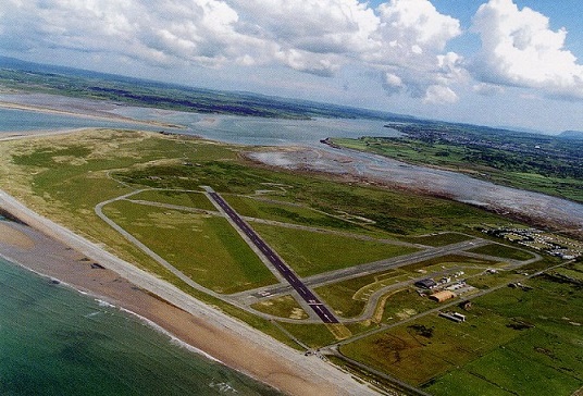
Note: This picture is scanned from a postcard and obviously taken by a complete amateur. But it was the only aerial image of CAERNAFON aerodrome I had to date. I posted a request: "If anybody can kindly provide a better picture, this will be much appreciated."
As the saying goes, "Ask and you will receive", - see below.
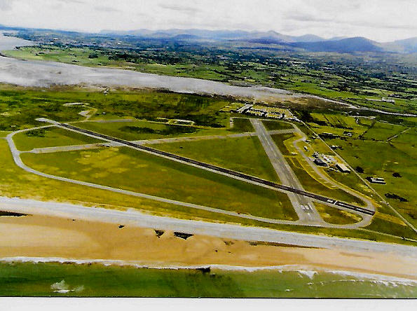
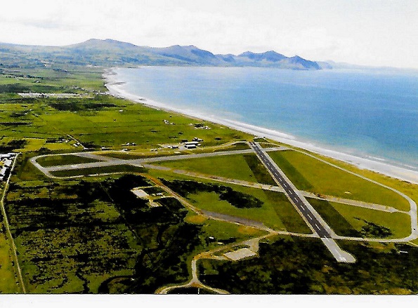
Note: In late 2017 Mike Charlton sent me these two images, also from postcards. He has an amazing collection - see, www.aviationpostcard.co.uk
The first image is an improvement and looks like it may have been taken on the same sortie? Perhaps the same applies to the second image, which is the one I prefer.
Military users: WW2: RAF Flying Training Command 25 Group
9 ATU {Observers Advanced Training Unit] (Avro Ansons & Westland Lysanders)
9 Air Gunnery School
9 Air Observers School
11 SFTS (Service Flying Training School)
Note: It appears that the Ansons and Lysanders served all these schools
31 & 277 MU (Maintenance Units)
Operated by: 1980s & 1990s: Snowdon Mountain Aviation
2000: Air Caenarfon Ltd
Flying club/school: 2000s: QDM Aviation, Reayair Flight Training
Pleasure flights: 1990s only? Air Atlantique
This picture from a postcard was also kindly sent by Mike Charlton, but the caption "Fort Belan" meant nothing at first. However, a bit of research revealed that 'Fort Belan' was a bomb dispersal faciity built near to the aerodrome and used by 31 M.U. to dispose of captured German Nerve Gas stored on the aerodrome since 1946. To doubly confuse matters there is an actual Fort Belan further up the coast. It could well be that the buildings in the background were those used by 31 M.U.
It appears that a road was built to transport the containers onto boats that were towed out and scuttled. Should I ever visit the area again, I think I'll stay well clear of eating locally sourced fish!
Location: On a peninsular N of A499, 3.5 nm SW of Caernarfon
Period of operation: Military 1941 to 1946. (Some say 1945) Later civil to present day
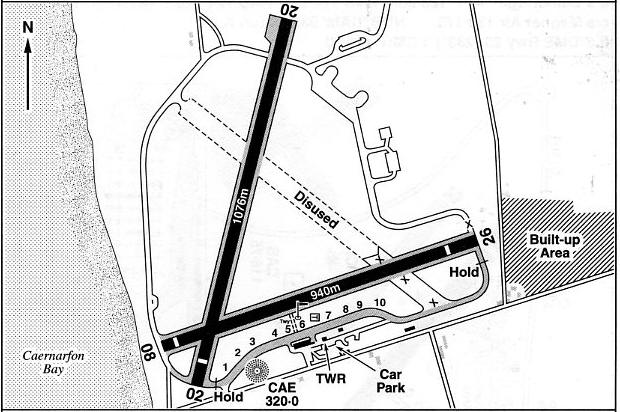
Note: This map is reproduced with the kind permission of Pooleys Flight Equipment Ltd. Copyright Robert Pooley 2014.
Runways: WW2: 04/22 1006x46 hard 09/27 914x46 hard
15/33 914x46 hard
1990: 08/26 940x23 hard
2000: 02/20 1076x23 hard 08/26 940x23 hard
2013: 08/26 932x23 hard 02/20 (Unlicensed)
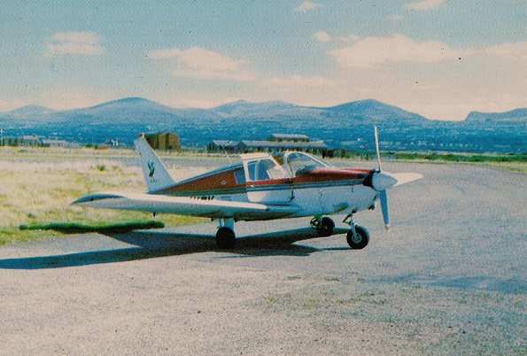
NOTES: In April 1993 my good friend and fellow pilot Guy Browning and I flew from WYCOMBE AIR PARK to CAERNAFON in the Cessna 172 G-WACL, and we were delighted to discover that Air Atlantique were offering pleasure flights in their DH89A Dragon Rapide G-AIDL. It was an altogether delightful experience and what a treat to view the castle at Conway from a Dragon Rapide.
PICTURES
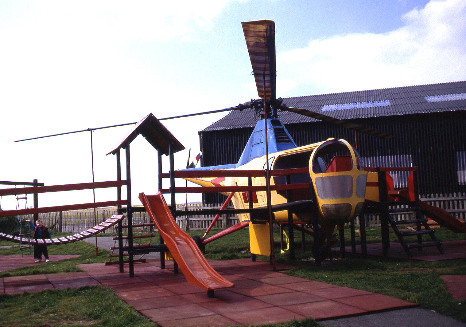
Notes: I was quite surprised to discover this Dragonfly here in 1993, incorporated into a childrens play area. See my article on Museums, Gate Guardians etc for more information regarding this particular aircraft.
We'd love to hear from you, so please scroll down to leave a comment!
Leave a comment ...
Copyright (c) UK Airfield Guide
