


Charlemont
CHARLEMONT: Private airstrip - possibly for microlight use only? (Aka THE MOY and KEENAGHAN)
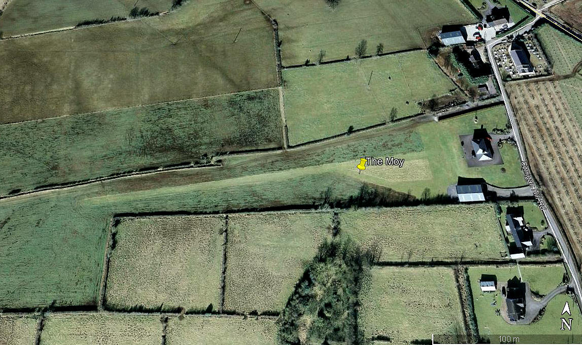
Aerial view 2010
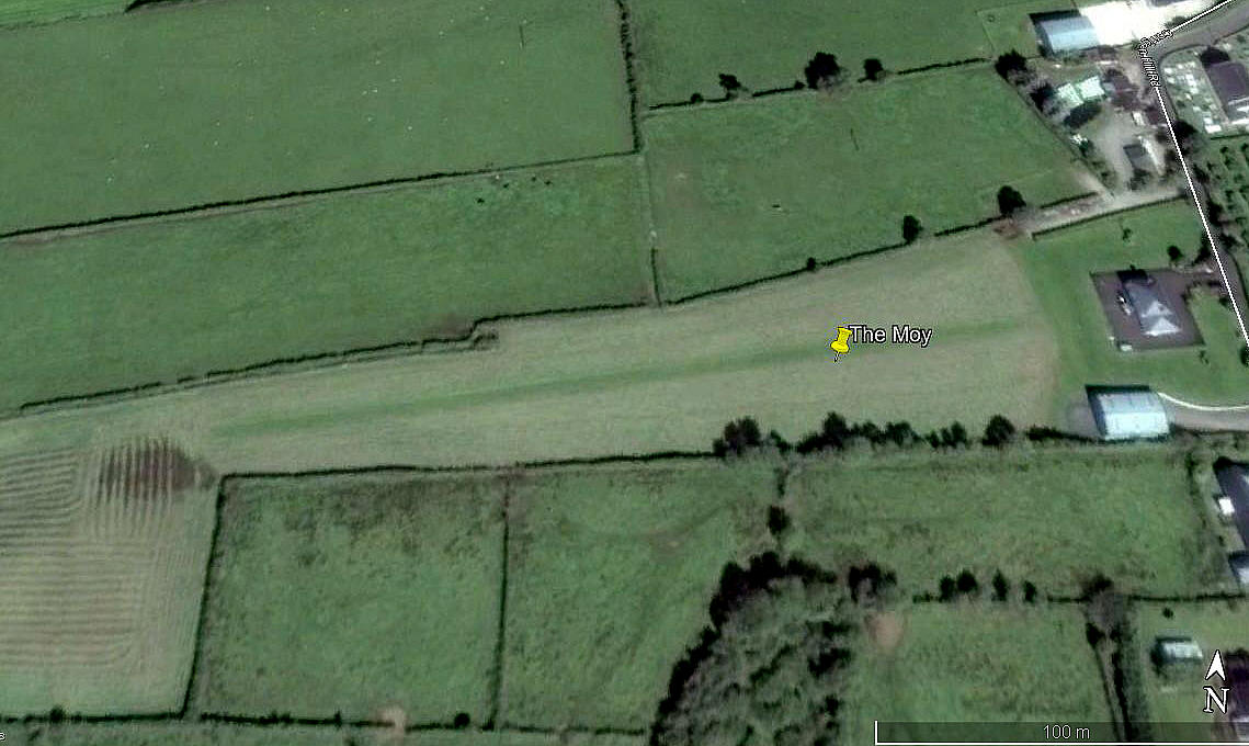
Aerial view 2016
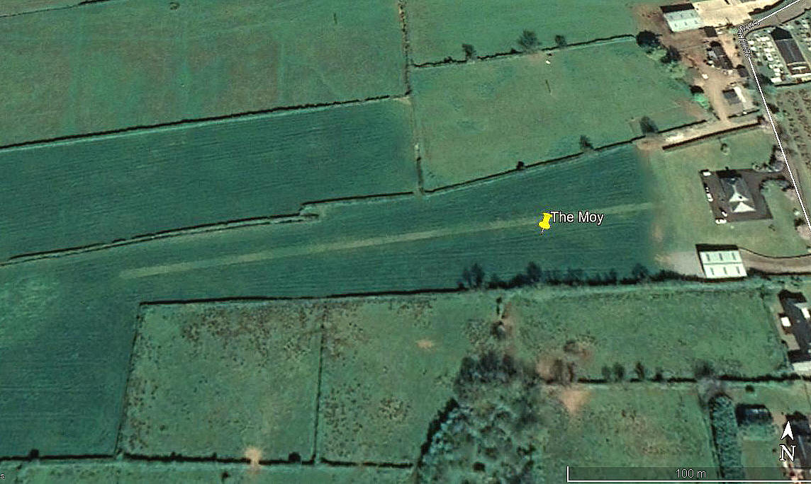
Aerial view 2020
Note: These three pictures were obtained from Google Earth ©
Location: E of the A29, about 0.5nm SE of Charlemont, roughly 1nm SE of Moy, and very roughly halfway between Armagh and Dungannon
Period of operation: Circa 2006 (?) to -
Runway: 08/26 270 grass
NOTES: The initial info source was the AAIB report EW/G2007/06/02. Further investigation in 2020 managed to track it down. My thanks go to Karel Adams, a great friend of this 'Guide' for prompting me to look at this, (what was), very sparse listing again.
Of anybody can kindly offer advice, this will be most welcome.
We'd love to hear from you, so please scroll down to leave a comment!
Leave a comment ...
Copyright (c) UK Airfield Guide
