


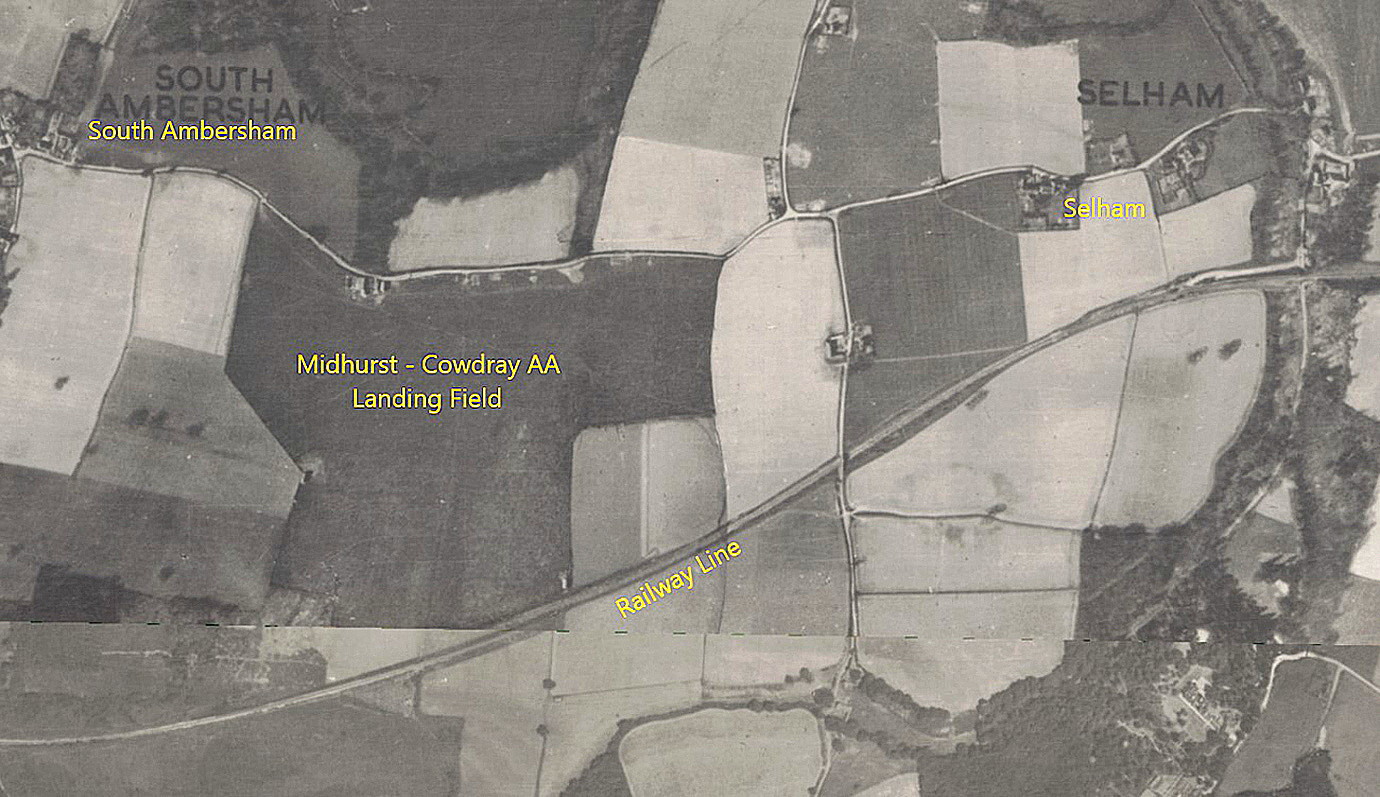
Cowdray Park flying sites
Note: This map shows the location of the A.A. Landing Ground, later WW2 airfield.
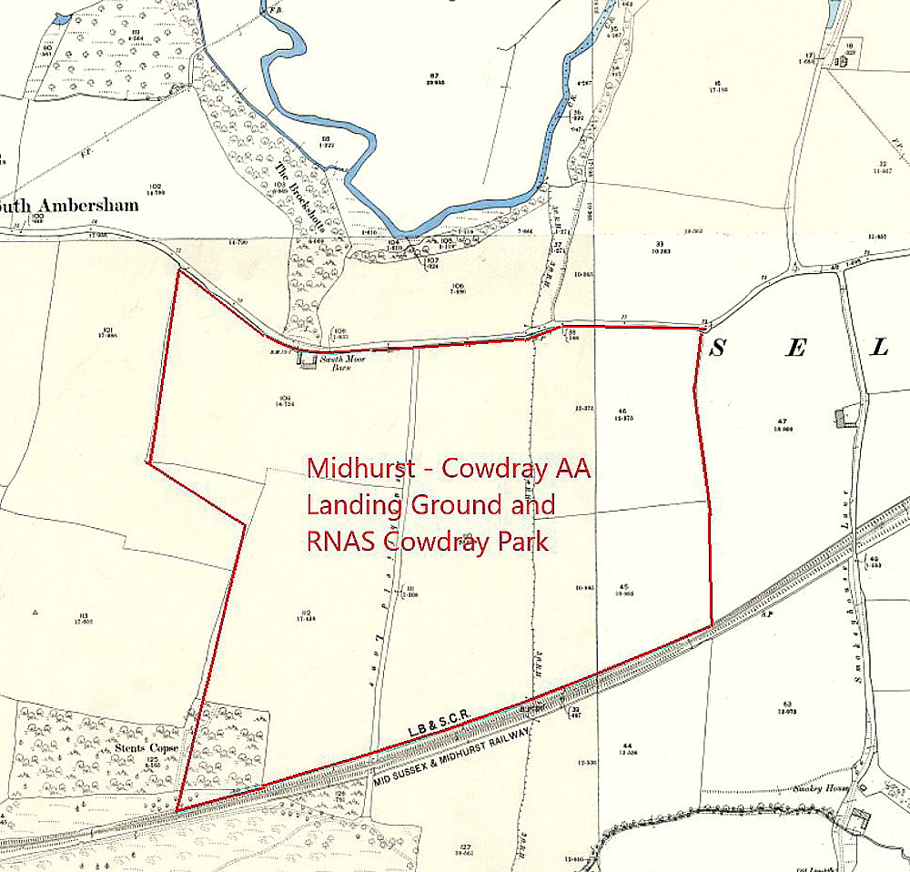
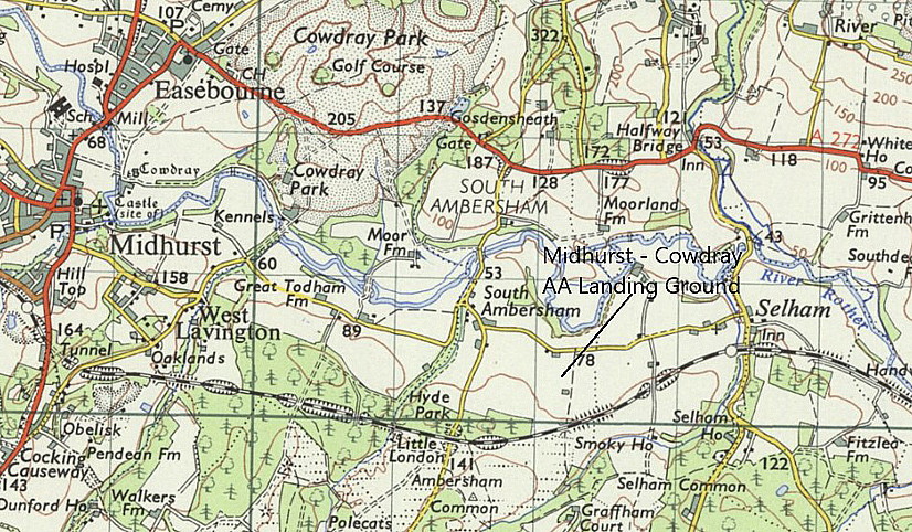
COWDRAY PARK: Civil A.A. (Automobile Association) Approved Landing Ground (Aka MIDHURST)
Operated by: Cowdray Estate Ltd
Location: “3.5m E Midhurst, S of road between S. Ambersham and Selham imm N of disused rwy.”
Period of operation: 1930s only?
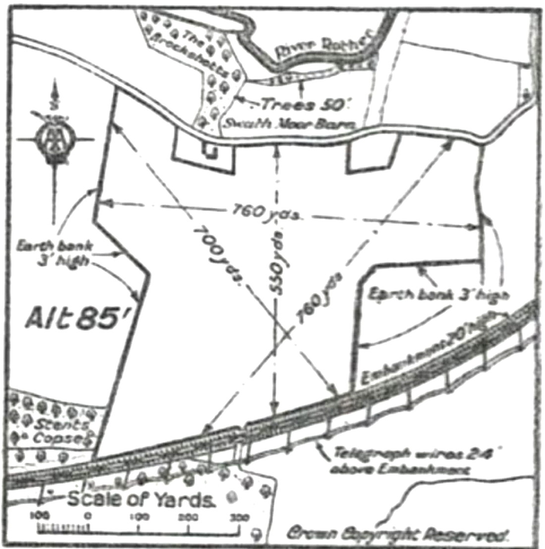
Runway(s): Max landing run: 695 grass
NOTES: Listed in the 1930s ‘A.A. Register of Landing Grounds’ and one of seventy-four A.A. (Automobile Association) approved Landing Grounds on mainland Britain in the 1930s.
A MICHAEL T HOLDER GALLERY
We have Mike Holder, a great long-term friend of this 'Guide', to thank for providing the following items which illustrate the two entirely different purposes this location served from the 1930s through to WW2 .
WW2: Photos from the R.N. Research Archive
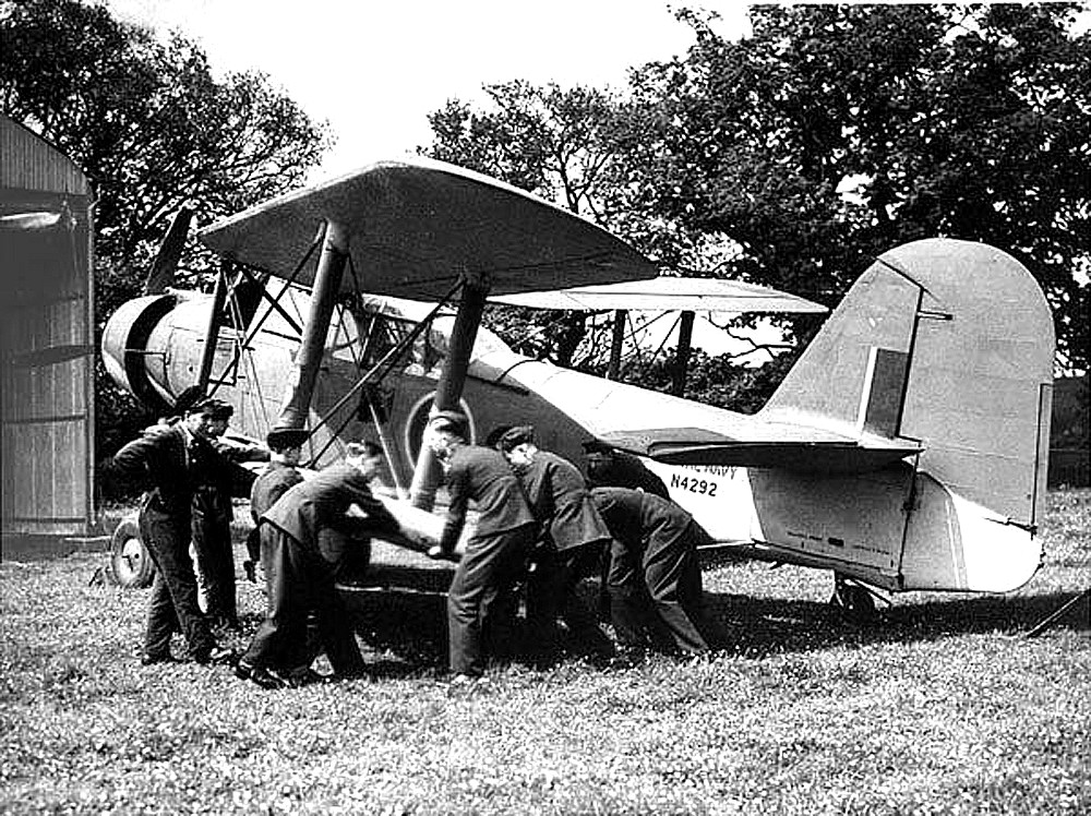
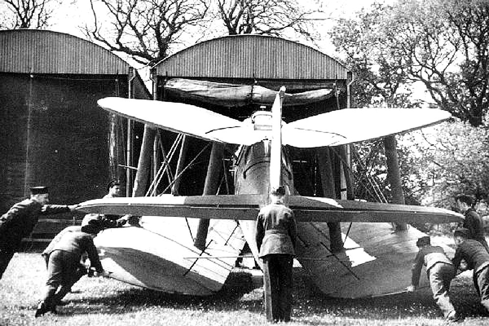
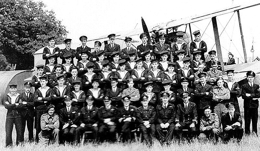
Photo One and Two show a Fairey Albecore being readied for storage.
FINAL ITEMS
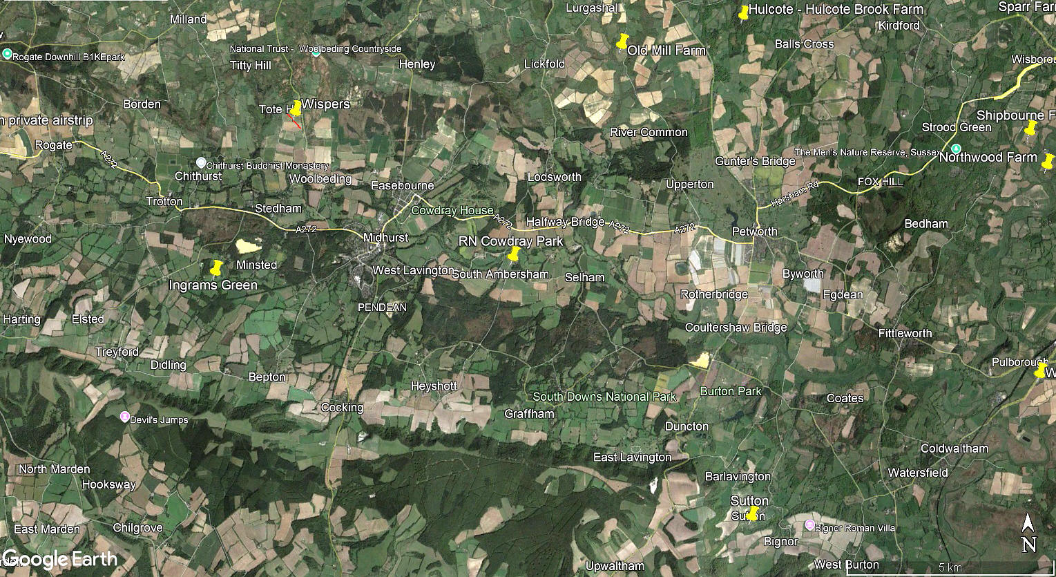
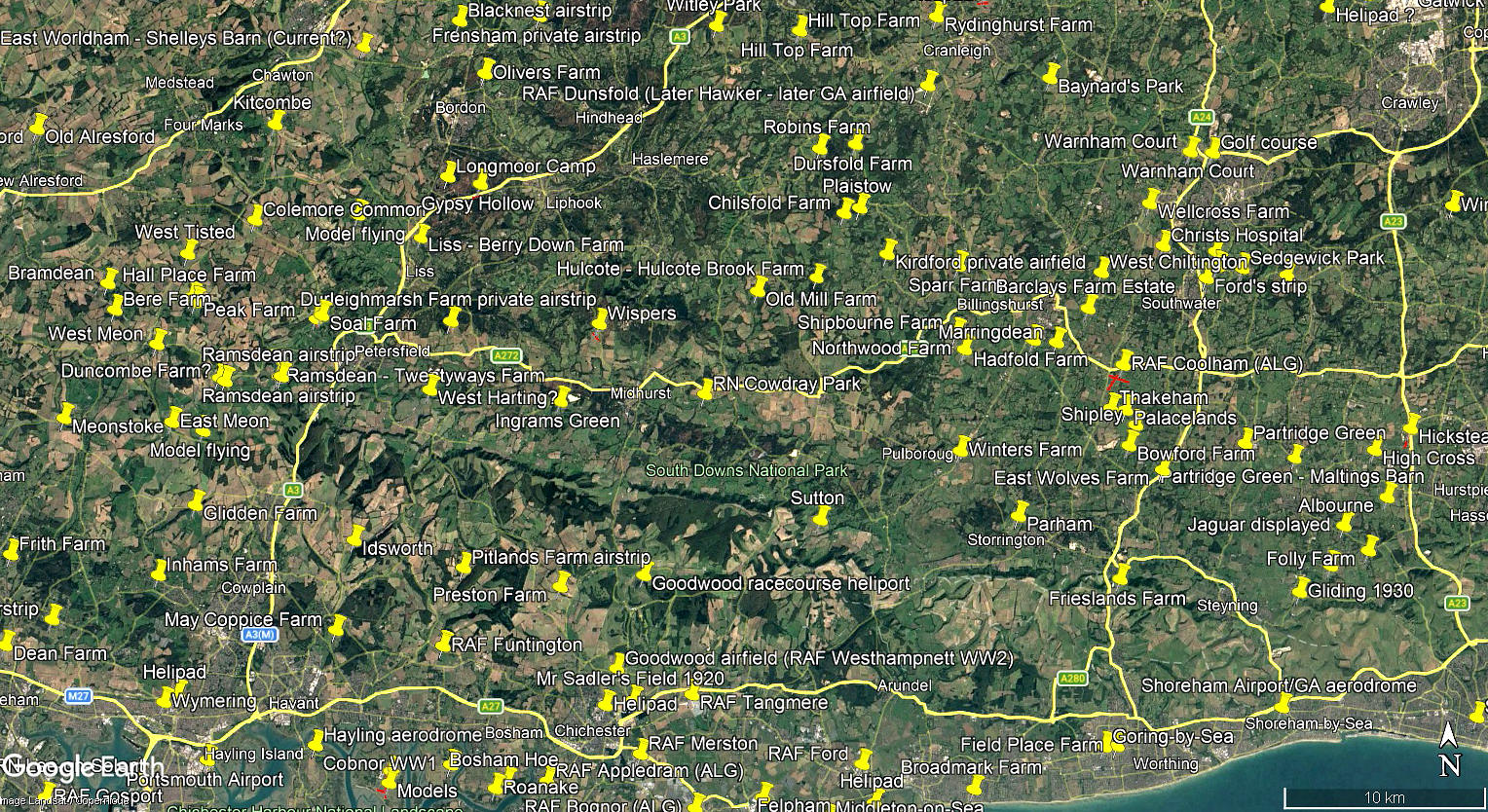
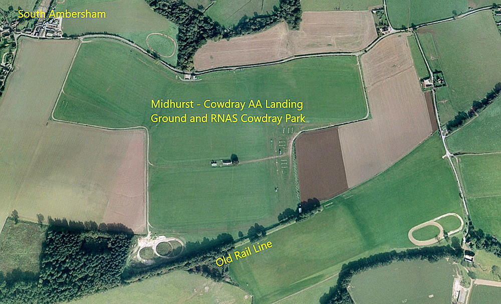
The local area and area views are from my Google Earth© derived database.
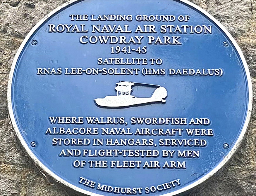
COWDRAY PARK: Military Landing Ground
Military user: Royal Navy (Books of HMS Daedulus), aka RNAS LEE-on-SOLENT
Activities: Dispersed storage
Location: 3.5nm ESE of Midhurst, on the site of the previous civil aerodrome
Period of operation: 1941 to 1945
Runways: N/S 505 grass E/W 685 grass
SOME INFORMATION
In 1941 the Admiralty requisitioned a portion of land from Lord Cowdray, previously a polo field and occassinal arodrome. They erected 25 Dutch Barns, dispersed around the site, for biplane aircraft storage from RNAS LEE-on-SOLENT. The first recorded aircraft, a Fairey Swordfish, (DK785), arriving on the 20th November 1941. Records appear to show that at least 16 Albacore, 12 Swordfish, 70 Walrus and one Sea Otter were stored here.
From the summer of 1943 and 1945 Air Training camps were held here, initially flight experience being in the Swordfish and later the Walrus. No record exists for 1944, no doubt due to activity related to the D-Day landings. Although no dates are known, it was probably during 1943 that specially modified Westland Lysanders of the RAF 161 Special Duties Squadron practiced the MPU (Mail Pick Up) method, the Lysanders being fitted with a retractable hook that could snatch a mail bag suspended between two poles which were lit for night use.
It also appears that operational flying occurred during two periods. The first being when the RN Photographic Development Unit arrived in April 1944 with four Avro Ansons from RNAS FORD remaining here until October 1944. It is also reported that Percival Proctors, (presumably from RNAS FORD?), did circuit practice here during late 1944 until early 1945 when the field was reduced to Care & Maintenance status before closing in September 1945.
COWDRAY PARK: Helicopter landing area
Location: E of Midhurst
Landing area: 1998, in paddock N of river & E side of River Ground
COWDRAY PARK HOUSE: Private helipad/helicopter landing area
Location: E of Midhurst
Landing area: 1998, in small paddock in SE corner of Lower House grounds
COWDRAY PARK POLO CLUB: Helicopter landing area
Location: E of Midhurst
Landing area: 1998, very large flat area similar to airfield
We'd love to hear from you, so please scroll down to leave a comment!
Leave a comment ...
Copyright (c) UK Airfield Guide
