


Fairlop WW1
FAIRLOP WW1. Military Landing Ground
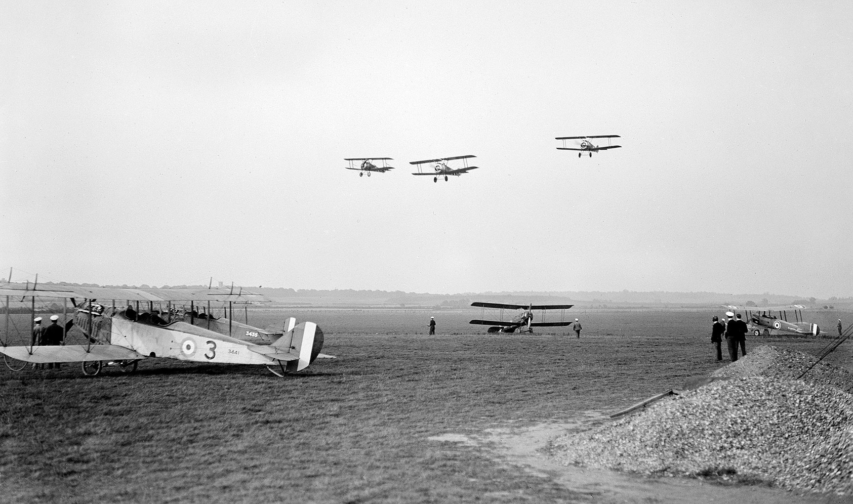
Military user: RFC (Royal Flying Corps)
39 [Home Defence] Sqdn (Royal Aircraft Factory B.E.2 & B.E.12 types)

In July 2017 I was kindly contacted by Alan Simpson who has been researching airfields in this part of NE London / Essex. I had thought that the WW1 and WW2 airfields had to be one and the same. Common sense dictates this and who could doubt it? But no, it was literally across the road!
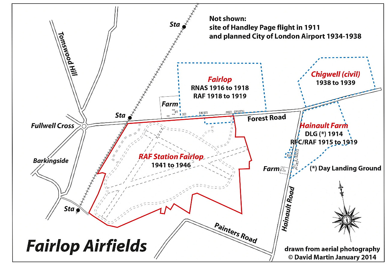
I reckon that this map, with four airfields adjacent to each other, represents a unique set of circumstances within the UK. As Alan kindly points out, this map is overdrawn on a map in John Barfoot's book ' Over Here and Over There'.

The local map and photo are under copyright from David Martin. The area view is from my Google Earth © derived database.
IN SUMMARY
There were six flying sites in this small area. The first being the "aerodrome" operated before WW1 by Handley Page. Occupying more or less the same area in WW1 was FAIRLOP used by the RNAS, later RAF. After WW1 a small civil aerodrome known as FOREST FARM was located at the western end of the WW1 aerodrome. Later in the 1930s CHIGWELL aerodrome/airport was developed, this location being east of the WW1 aerodrome.
All of these sites were just north of Forest Road. Just to the south of Forest Road, roughly south of CHIGWELL we have the WW1 aerodrome HAINULT FARM. And much later in WW2, just to the west, the RAF FAIRLOP aerodrome.
June Hurrell Rushmer
This comment was written on: 2025-09-16 02:02:13In 1952 a friend was stationed at what I thought was Fairlop Aerodrome…his name John Branch, I’ve been searching for him since but unfortunately I emigrated to Australia in the 50s and lost touch
We'd love to hear from you, so please scroll down to leave a comment!
Leave a comment ...
Copyright (c) UK Airfield Guide
