Peterborough flying sites
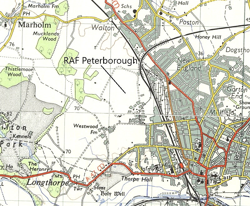
Note: This map shows the location of the WW2 airfield.
PETERBOROUGH see also CAMBRIDGESHIRE for GLATTON / CONINGTON
PETERBOROUGH see also HORSEY TOLL
PETERBOROUGH: Balloon - parachuting demonstration site
Period of operation: Bank Holiday 1895
NOTES: Ever since the late eighteenth century and especially during the middle of the nineteenth century a single balloon ascent could draw large crowds. This was of course the equivalent of a ‘Space Shuttle’ launch. However, by the late nineteenth century it was realised that an extra attraction was needed and this was usually parachute descents, especially if performed by a woman.
As with any air show today I suppose it must be recognised that many people are drawn to the event by the prospect seeing a serious and possibly fatal crash? According to Mary Cadogan in her book Women with Wings, “…it seemed to be recognised by the last decade of the nineteenth century that female parachutists drew larger audiencies than men.”
At this show, “Mademoiselle Adelaide Basset’s fall to her death was witnessed by a large group of spectators. She and her partner, Captain Orton, planned to make simultaneous parachute jumps, but the wires became detached from Adelaide’s ‘chute – with tragic results.”
Just as with fatal accidents at air shows today, this event did nothing to dissuade others taking part, following closely behind. Mary Cadogan gives the example: “Only two or three days later Captain Spencer and Miss Alma Beaumont, made a successful jump.” But, typically, she doesn’t mention where this took place
PETERBOROUGH: Civil Landing Ground (Aka SHORTACRES)
Also known as HORSEY TOLL - see seperate listing
Operated by: Mr Kenneth Whittome, Shortacres, Peterborough
Location: Just N of the A605, roughly 2.5nm SE of Peterborough city centre
Period of operation: May 1930 to around the early 1950s
Runway(s): Max landing run: 347 grass
NOTES: Listed in the 1930s ‘A.A. Register of Landing Grounds’ and one of seventy-four approved A.A. (Automobile Association) landing grounds on mainland Britain in the 1930s. Unusually this site had a petrol pump on the LG but it was also noted that fuel could be obtained from Reeds Garage which suggests that the fuel supply on the LG wasn’t always available. Very unusually the name of a local taxi provider is not provided and instead it appears that a regular bus service was. I cannot quite envisage the class of person flying in with their own aircraft, (as opposed to a club aircraft), being overkeen on using a bus service.
Three hotels in Peterborough were recommended, the Angel, Bull and Saracens Head. The Angel appears to have closed (?) although a book on its history is listed on Amazon. The Bull and Saracens Head were still in business in 2013. I also found a short film clip on the internet of Reeds Garage, Broadway, Peterborough taken during a ‘Buy British’ campaign in the 1930s. Unlike the hotels of the period, a great many of which survive, the garages still in business of that period are very few and far between and most offered a taxi service.
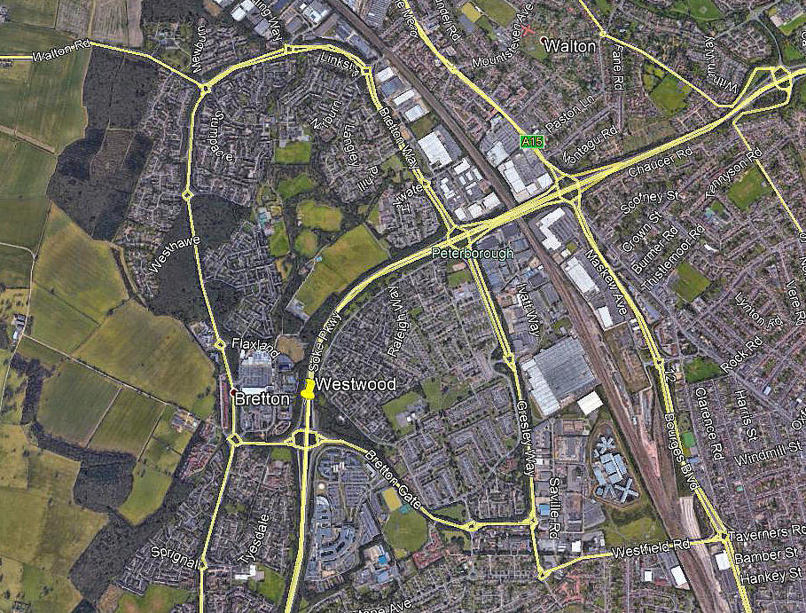
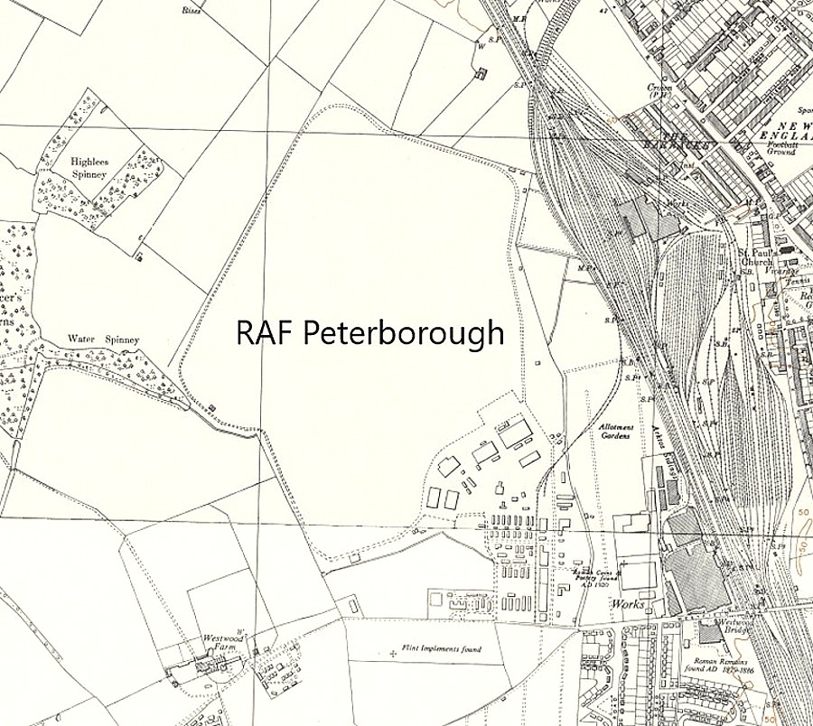
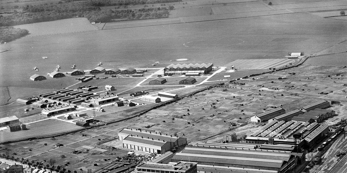
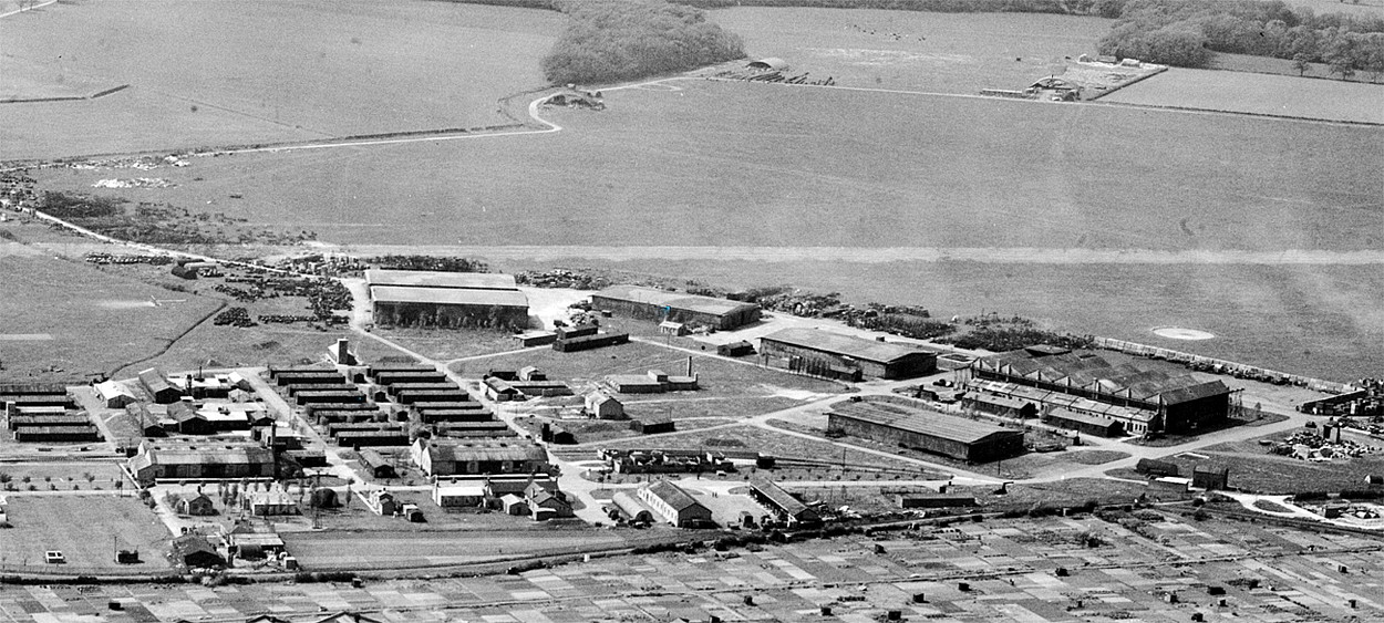
PETERBOROUGH: Military aerodrome (Aka WESTWOOD AIRCRAFT PARK - see seperate entry)
Note: This picture was obtained from Google Earth ©
Military users: WW2: RAF Flying Training Command 21 Group
7 AFU (Hawker Hurricanes, Vickers-Supermarine Spitfires and Airspeed Oxfords)
3 FTS
Note: We have Mike Holder, a great friend of this 'Guide', to thank for providing these items.
Location: W of Millfield, 1.5nm NNW of Peterborough
Period of operation: 1932 to 1964
Runways: WW2: NNE/SSW 1097 grass NE/SW 933 grass
ENE/WSW 713 grass SSE/NNW 713 grass
NOTES: In late 1944 still a pretty busy training establishment with 840 RAF and 215 WAAFs. Compared to many similar training aerodromes this one had a fairly lengthy service life.
PETERBOROUGH: Civil heliport
Operated by: BEA (Helicopter Experimental Unit)
Location: Westwood airfield (Aka RAF PETERBOROUGH)
Period of operation: June to September 1948
NOTES: Details are sketchy but it certainly appears BEA started this mainly experimental service using at least one Westland Dragonfly and possibly a couple of early Bell helicopters, (judging from various photographs taken around this period), for route proving duties. PETERBOROUGH was the base and NORWICH was an en route refuelling site. For convenience I will divide the “route network” into four basic sectors of my making as nothing to date seems known as to exactly which sectors were actually flown, or in what order.
Route A: PETERBOROUGH, KINGS LYNN, WELLS, SHERINGHAM, CROMER, NORWICH & EAST DEREHAM.
Route B: PETERBOROUGH to DOWNHAM MARKET (Night Experimental sector)
Route C: PETERBOROUGH, DOWNHAM MARKET & NORWICH (Saturday only service).
ROUTE D: Described on the route chart as a “figure of eight” it started in NORWICH, went to BECCLES, LOWESTOFT and YARMOUTH before crossing SW to HARLESTON, then DISS and THETFORD, then returning to NORWICH. This route,
along with the ‘A’ route, may have been flown the other way round of course.
What seems of particular interest is that it seems from limited evidence that rudimentary heliports were often established rather than using established aerodromes. Does anybody know why this was? A aerial photograph exists captioned the heliport at DISS and it is pretty difficult to ascertain with certainty where it was, even looking at the photograph through a magnifying glass! This said there does seem to be a paddock with little more than a shed and, a windsock just visible? For me at least the really important factor is that BEA were conducting helicopter route proving “experiments” using helicopters in 1948! Considering how quickly that airline eventually fell apart in nearly every aspect of their operations, alledgedly due to mostly massive mis-management as well as government intereference, I think it must be remembered that in the early days at least, it really was a pioneering airline. It was of course British Government owned so is it any wonder it eventually foundered?
There is another point of question, according to modern maps it’s open to question to whether or not the “heliports” at BECCLES, HARLESTON, DISS and THETFORD were in NORFOLK or SUFFOLK as they are all on the modern County boundaries. If asked to guess I’d reckon these heliports were all in NORFOLK. I do know that in more recent times influential factions in SUFFOLK, especially those in local government are fanatically anti-aviation, and it appears that it is also entirely possible that such or similar people were against the British war opposing the Nazi regime in 1939 and this has “carried over”? Needless to say, one has to be very wary of the agenda of the people making such accussations.
This said, it has been proven to be utter bunkum that all of the British people were anti-Nazi in WW2, and it now seems at least likely that many highly influential SUFFOLK people were perhaps fundamentally pro-Nazi whereas similarly placed people in NORFOLK were mainly allied against them? Indeed, there are many reports of influential people in the Church of England who actively opposed the war effort.
As is often said, “actions speak louder than words”, and the effects seep down through history time and time again. Food for thought perhaps?
PETERBOROUGH: Temporary landing strip
Location: Thorny Road
NOTES: Info source AAIB report EW/G2010/06/25. It appears the young pilot, (also owner?), of the X’Air Falcon 912 G-CBVE had arranged to land here to support a local fete. But, he did not walk the entire distance of the strip he intended to land on and subsequently, late in the landing run ran into a ditch causing considerable damage to the aircraft.
In the earlier days of aviation forced landings in fields were a common occurrence but, or so it seems, the pilot rarely experienced this sort of hazard? Could it be that with the advent of mechanical diggers it is now all too easy for farmers to lay, (presumably for drainage?), ditches across their fields? Whatever the reason it is quite common in recent years for light aircraft to come to grief in ditches, even when using established farm strips.
We'd love to hear from you, so please scroll down to leave a comment!
Leave a comment ...
Copyright (c) UK Airfield Guide


