


Scotland Farm
SCOTLAND FARM: Private airstrip (Usually known as HOOK)
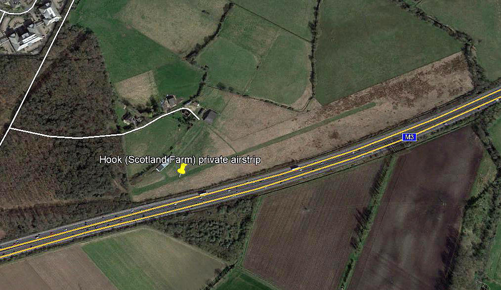
Note: This picture was obtained from Google Earth ©
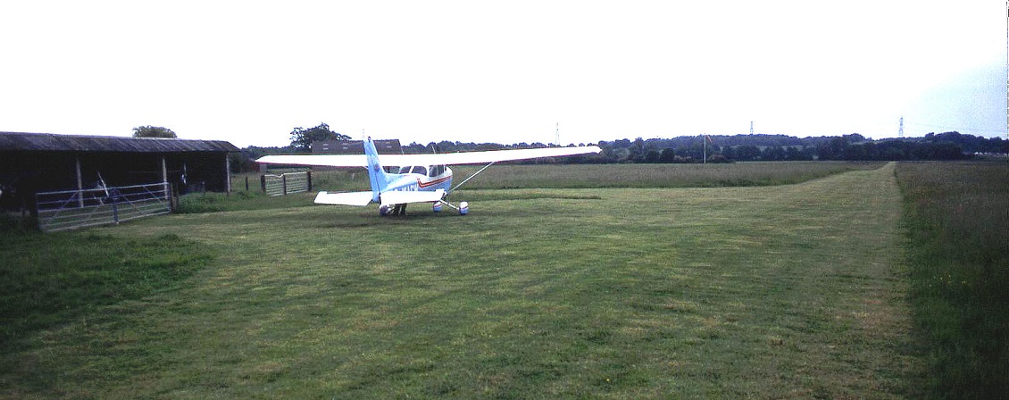
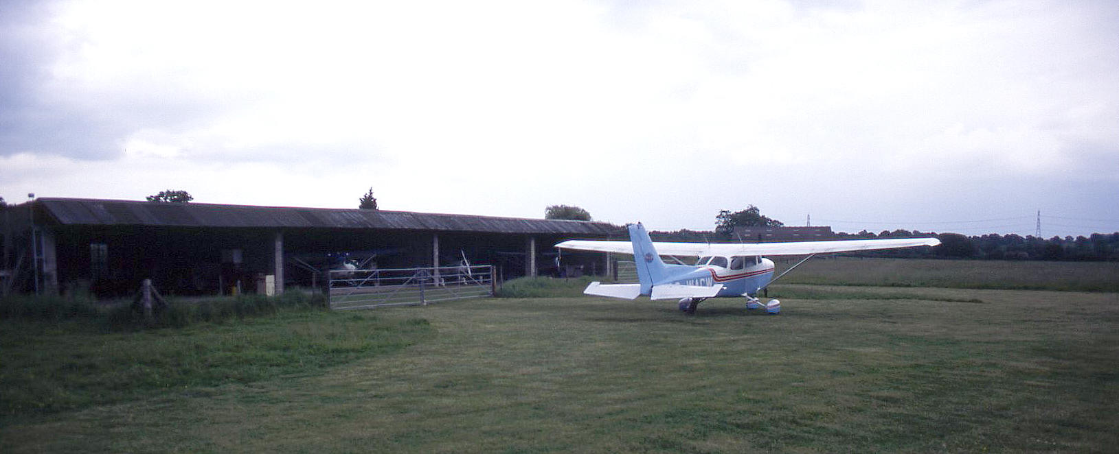
Note: Pictures by the author.
Location: Alongside & N of M3 just E of junction 5 near & E of Hook
Period of operation: 1970s to - 2017?
Runway: I have flown into this airfield as P/1 with my pilot friend Guy Browning but I’d have to guess the runway dimensions. The maximum runway length during a dry period is quite long, about 800m probably, but it’s generally only the western end which is regularly used, the eastern end often being quite boggy after rainy periods. The mown width when I landed a few years ago was pretty narrow, (about mainly 4 metres seeing the video Guy made and my picture), and certainly much less than the wingspan of the Cessna 172 we were using.
NOTES: There is another problem too if using an aircraft like a 172 as you usually have to approach from the east due to high trees bordering the western end of the runway with high electricity pylons not too far W as well! Therefore it can be considered as being a ‘one way in, the other way out’ airstrip for ‘regular’ GA types. In other words suitable for use only in calm conditions. But, there is a danger lurking which I discovered when taking off.
Fortunately I was already aware of this possibility. Quite often a reasonably strong westerly wind, (the prevailing wind on this day), can be blowing even at 50 to 100ft above ground level even when the windsock is hanging down the pole and this turned out to be the case when we visited. We landed here towards the west, (the strip is orientated roughly 08/26), and we took off towards the east. At about fifty feet we encountered a fairly strong tailwind which resulted in a very slow rate of climb indeed.
The problem was there are more big electricity pylons with their cables to the east, (clearly seen in the picture), and it soon became apparent we probably weren’t going to clear those! The only solution was to slowly turn away towards the east, (steep turns at low airspeed with a tailwind are not an option especially when close to the ground as the aircraft can very easily stall), and we passed very low over the M3. I only hope that drivers on the M3 that day weren’t too distracted by this unexpected spectacle.
Under 'Air Law' this procedure is potentially illegal of course. However, the Captain of an aeroplane can ignore all Laws and Regulations in order to safeguard the complete safety of the aircraft and passengers. And that is my defence M'lord.
CLOSED?
These days (written 2018) I regularly drive down the M3 on family visits and this airfield appears to have been closed for the last year or so? If anybody can kindly offer advice, this will be most welcome.
We'd love to hear from you, so please scroll down to leave a comment!
Leave a comment ...
Copyright (c) UK Airfield Guide
