Sole Street - UK Airfield Guide

Now having 7,000 + listed!

Probably becoming the most extensive British flying sites guide online...?

portfolio1 portfolio2 portfolio3 portfolio4

Heading 1

This is an example of the content for a specific image in the Nivo slider. Provide a short description of the image here....

Heading 2

This is an example of the content for a specific image in the Nivo slider. Provide a short description of the image here....

Heading 3

This is an example of the content for a specific image in the Nivo slider. Provide a short description of the image here....

Heading 4

This is an example of the content for a specific image in the Nivo slider. Provide a short description of the image here....

small portfolio1 small portfolio2 small portfolio3 small portfolio4
themed object
A Guide to the history of British flying sites within the United Kingdom
get in touch

Sole Street


SOLE STREET: Military Landing Ground  (also known as CRUNDALE)
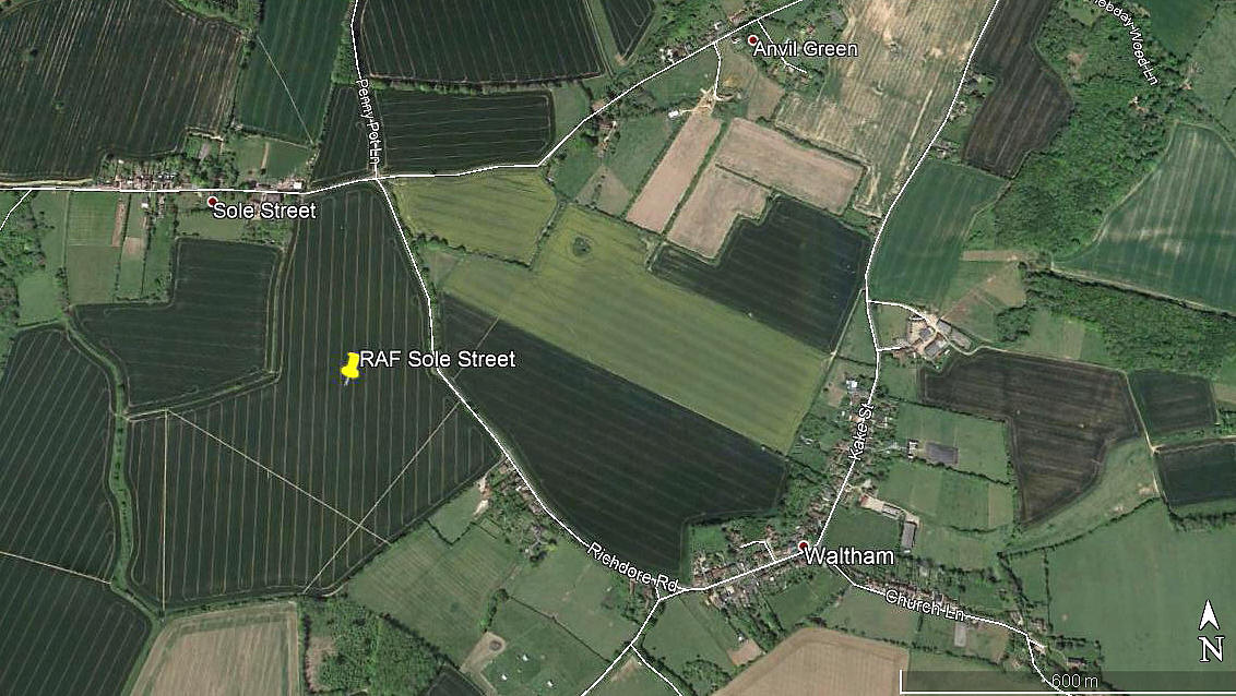
Area view
Area view


Note:  This picture was obtained from Google Earth ©

Once again I have to thank the Airfields of Britain Conservation Trust for pin-pointing this location.


Military users: RFC/RAF   (Royal Flying Corps / Royal Air Force)

50 [Home Defence] Sqdn  (Royal Aircraft Factory B.E.2 & B.E.12, Armstrong Whitworth F.K.8 & Sopwith Camels
 

Location: Just S of Sole Street, E of Crundale, about 1nm WNW of Waltham, roughly 7nm NE of Ashford town centre 

Period of operation: 1917 to 1919
 

Site area:  21 acres      320 x 366
 

NOTES: Not to be confused with the much larger WW1 WYE aerodrome fairly nearby.


We'd love to hear from you, so please scroll down to leave a comment!


Leave a comment ...


Name
 
Email:
 
Message:


Copyright (c) UK Airfield Guide


slide up button