


Tibenham flying sites
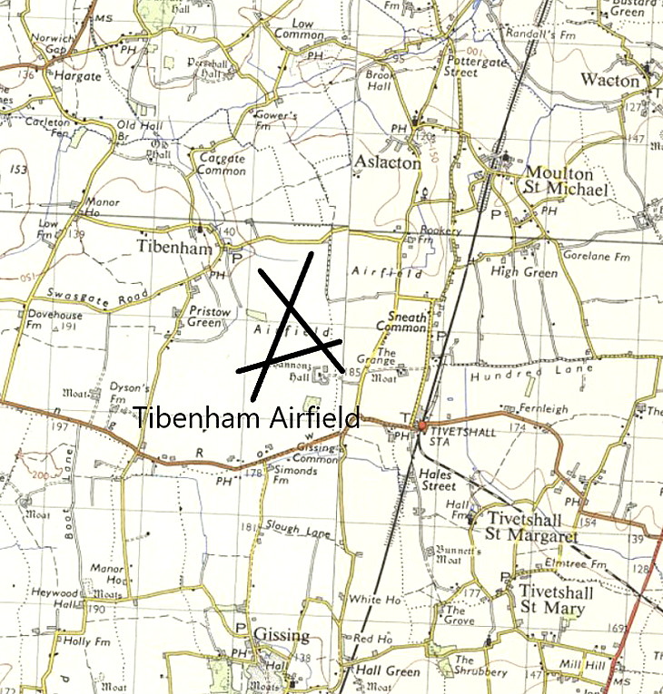
Note: The map shows the WW2 airfield location, now a gliding site.
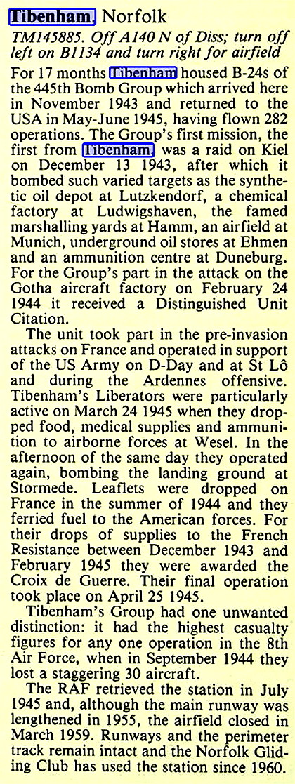
TIBENHAM see also PRIORY FARM
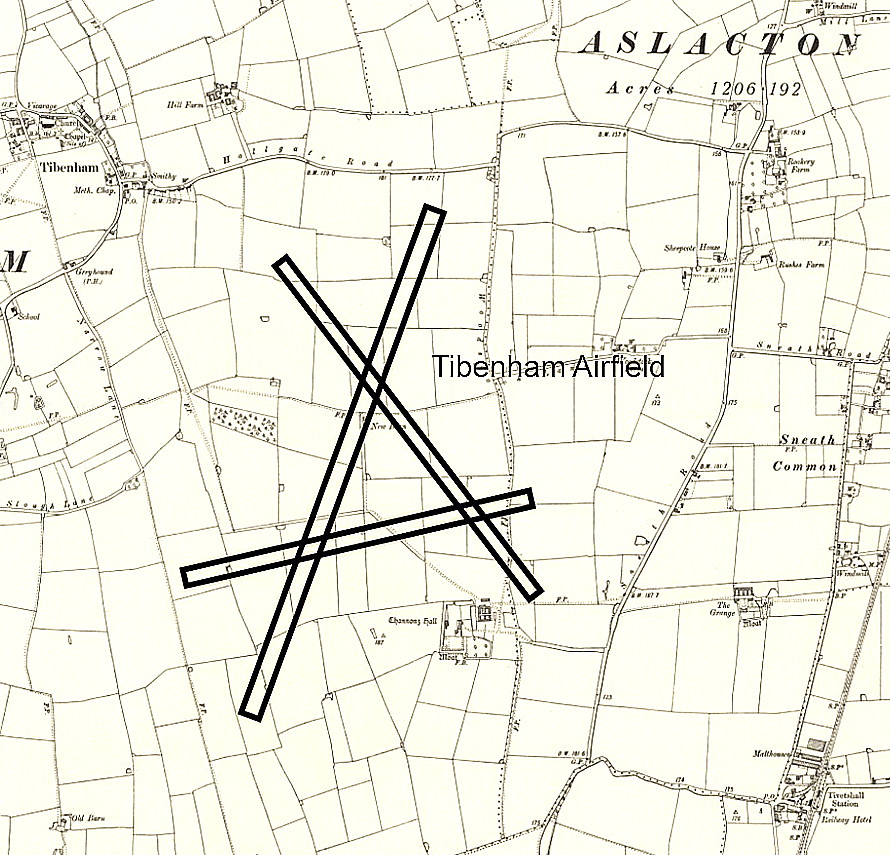
TIBENHAM: Military Landing Ground
Military users: RFC/RAF
51 & 75 (Home Defence) Sqdns (BE.2s & BE.12s)
Note: It is possible that 75 Sqdn at least, may also have later flown Avro 504s and Sopwith Camels here.
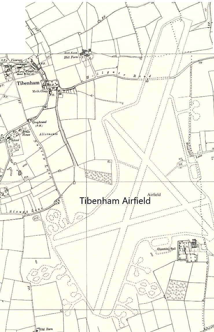
Location: On Tibenham Farm? About 0.5nm SW of Tibenham, N of the B1134, about 5.5nm SE of Attleborough and also about 1nm W of the WW2 TIBENHAM aerodrome
Period of operation: 1916 to 1919
Site area: 30 acres 457 x 366 grass
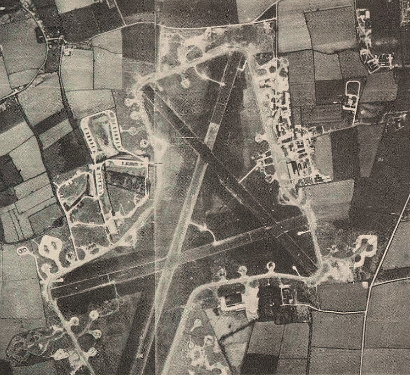
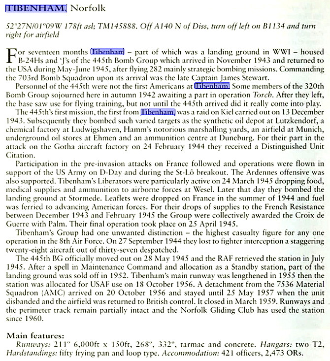
TIBENHAM: Military aerodrome late civil gliding site with aero-tows
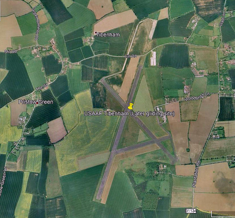
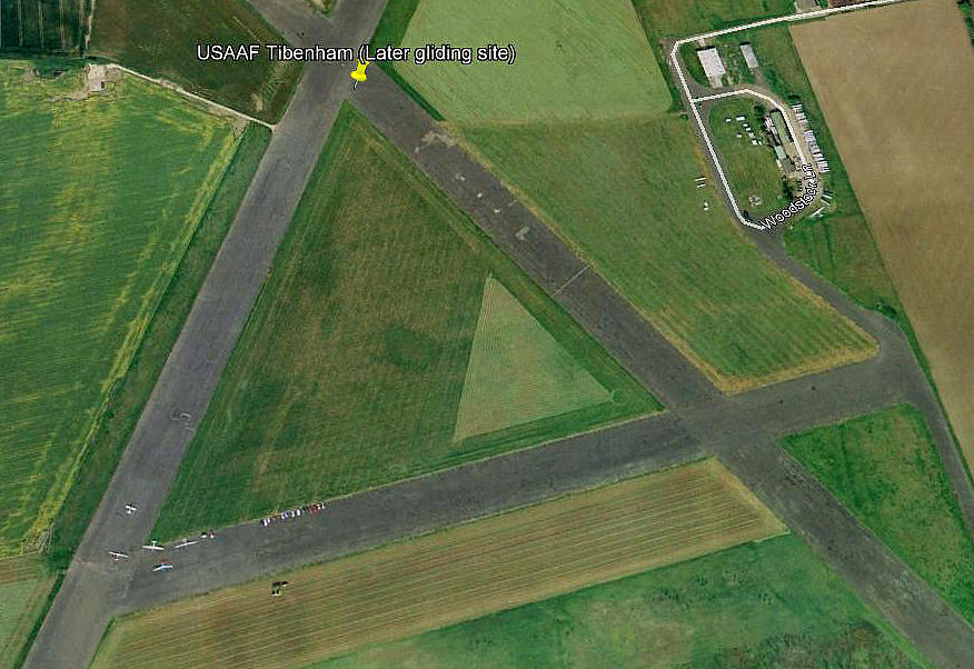
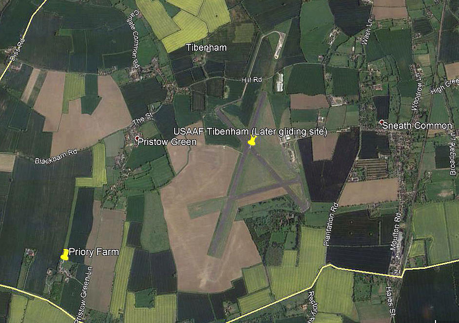
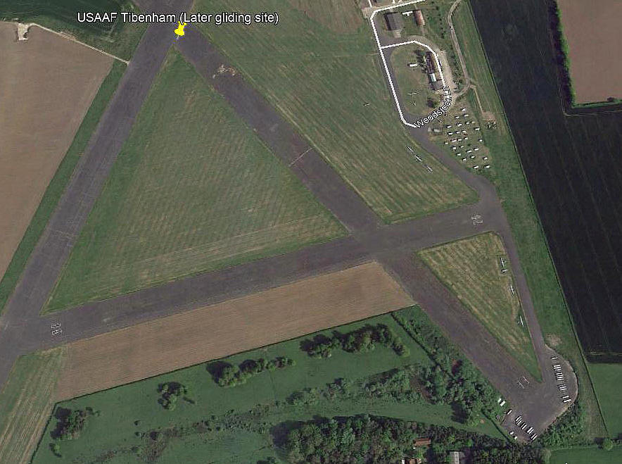
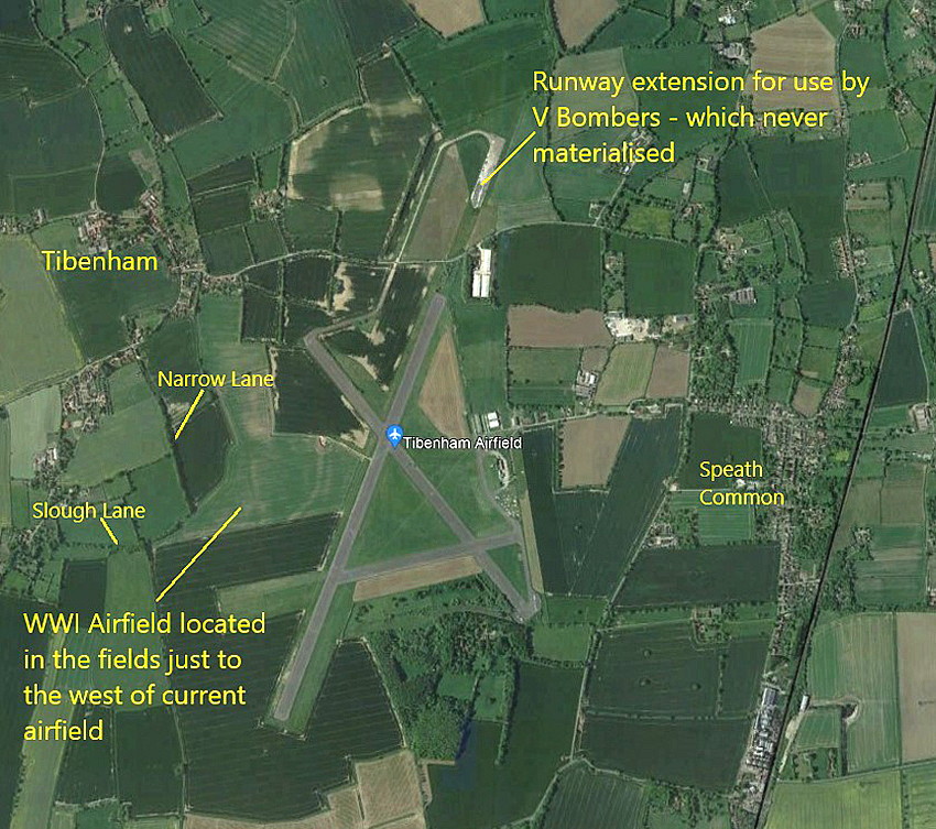
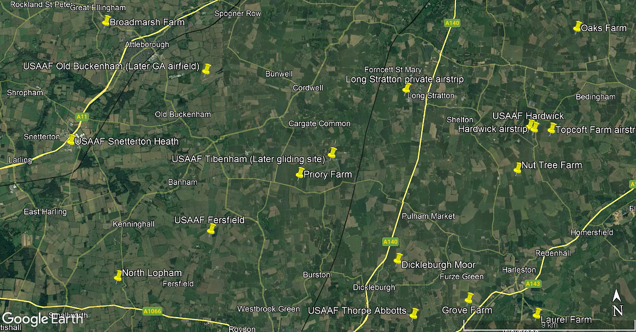
Note: All four of these pictures were obtained from Google Earth ©
Military user: WW2: 8th USAAF 2nd Bombardment Wing 455th Bomb Group
700, 701, 702 & 703 Sqdns (Consolidated B-24 Liberators)
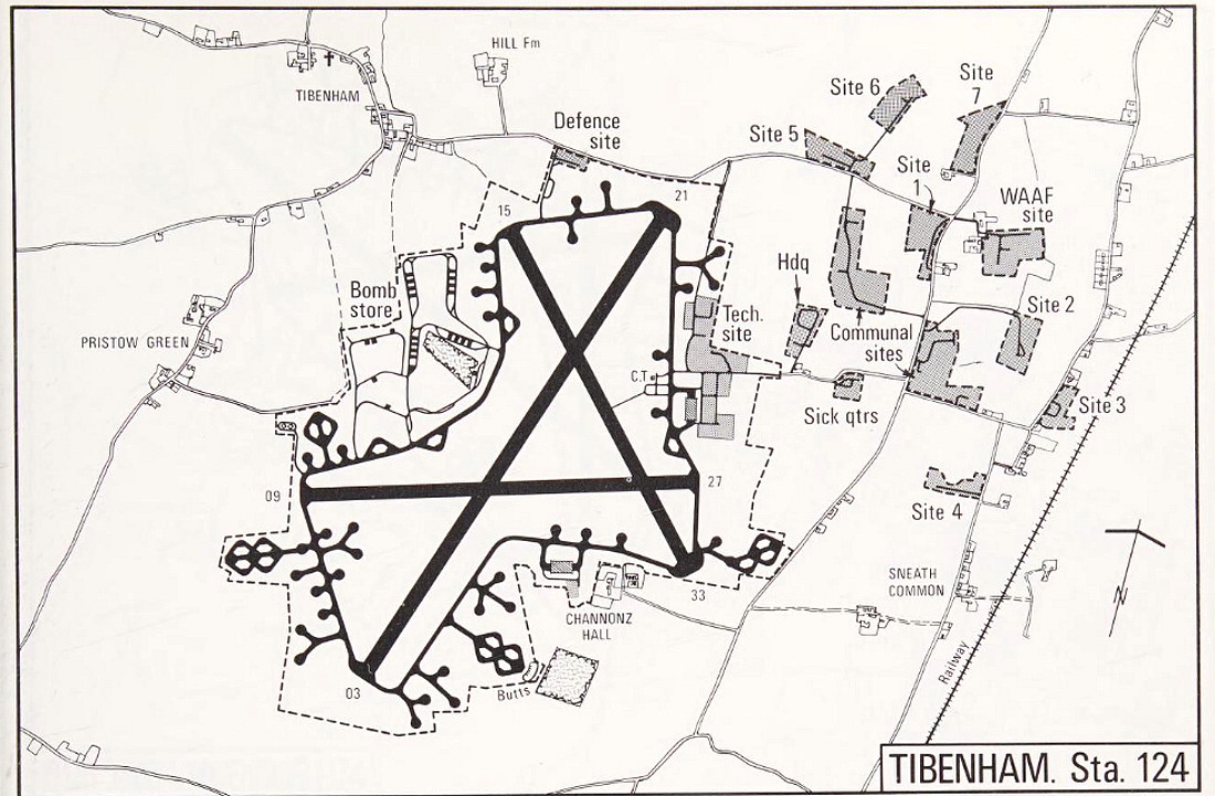
Note: This map was obtained from the Mighty Eighth War Manual © by Roger A Freeman.
Operated by: 1970s to - : Norfolk Gliding Club
Location: N of B1134, just SE of Tibenham, W of Sneath Common, 13nm SSW of Norwich
Period of operation: Military: 1942 to 1959. Gliding from 1970s (?) to today.
Runways: WW2: 03/21 1829x46 hard 08/26 1280x46 hard
15/33 1280x46 hard
2000: 03/21 914x46 hard 08/26 700x46 hard
15/33 914x46 hard
A MICHAEL T HOLDER GALLERY
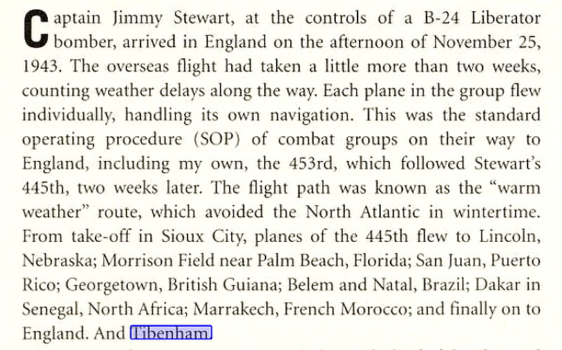
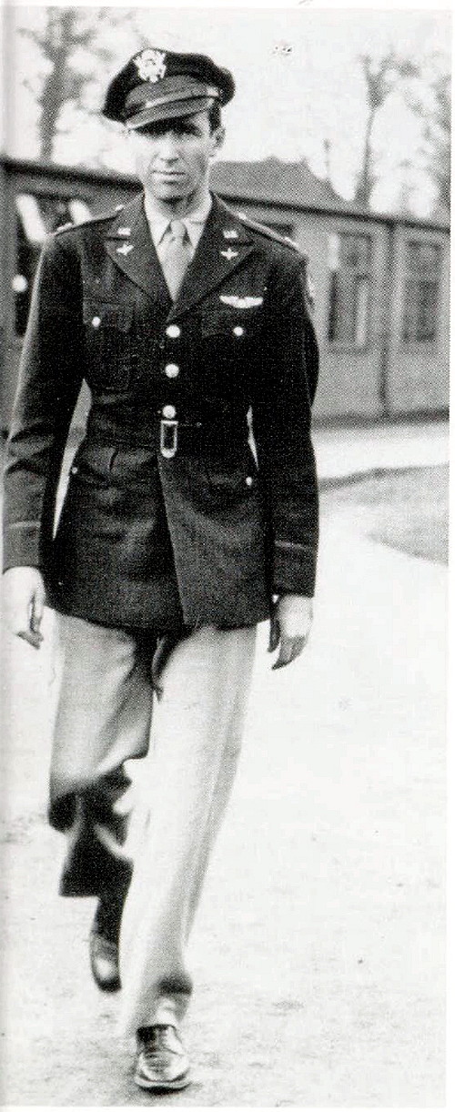
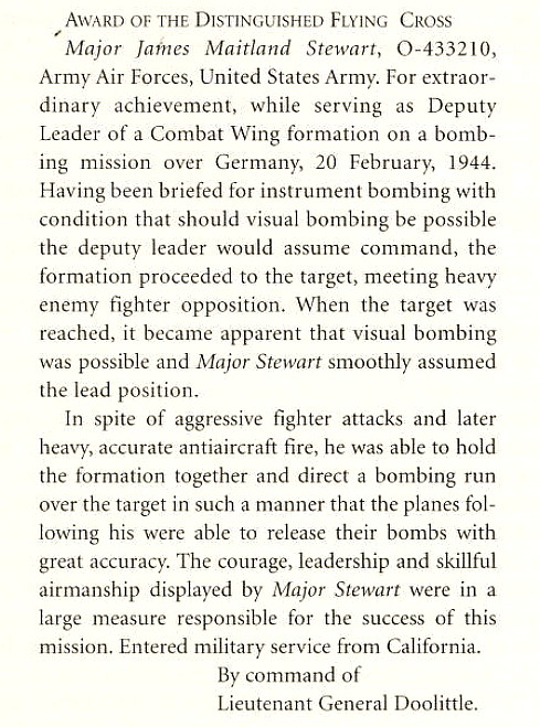
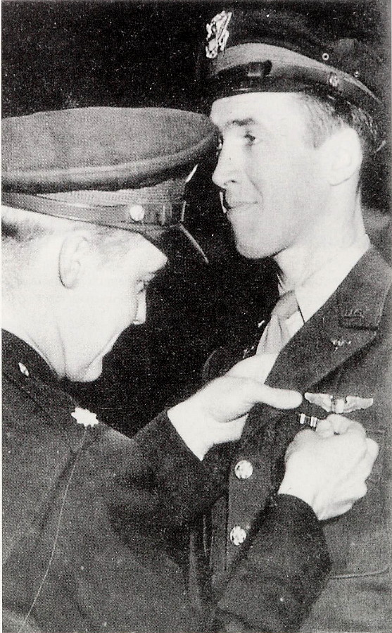
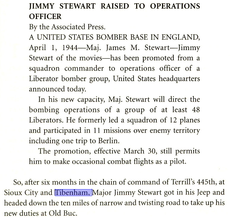
Note: The third item is an excerpt from Jimmy Stewart Bomber Pilot by Starr Smith.
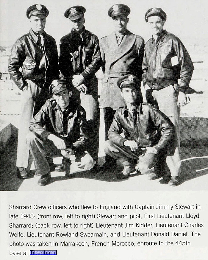
Note: The fifth item is a photo from Jimmy Stewart Bomber Pilot, showing the crew in Marrakech whilst en route to TIBENHAM. The sixth item is an excerpt from Action Stations by Michael J F Bowyer. The eighth item is also from Jimmy Stewart Bomber Pilot.
Note: The ninth and tenth items are also from Jimmy Stewart Bomber Pilot.
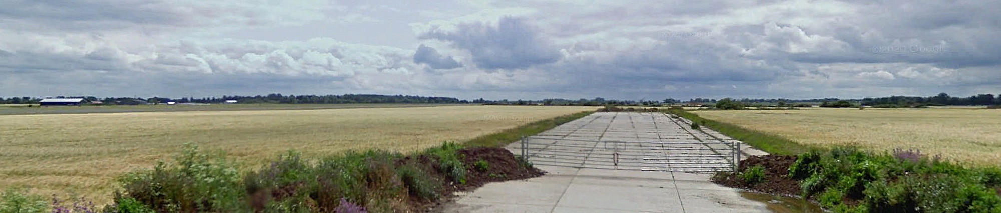
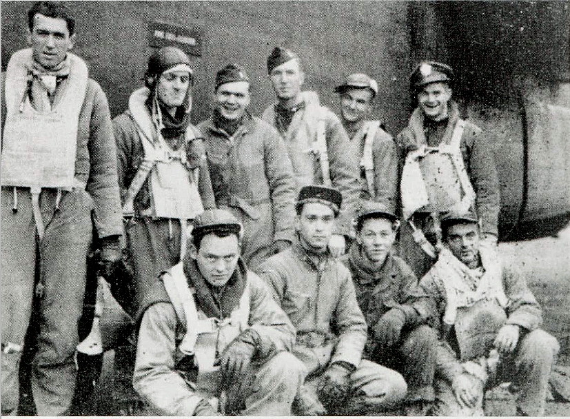
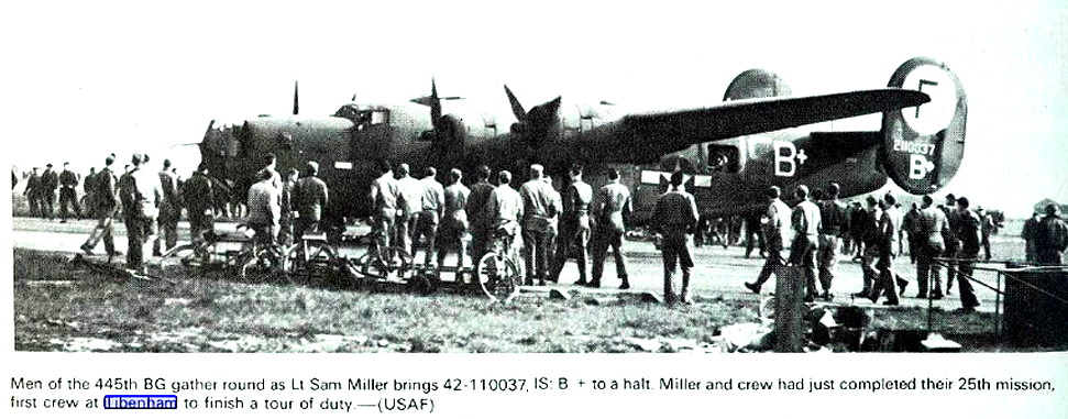
Note: The thirteenth item is an excerpt from Action Stations Revisited by Michael J F Bowyer. The Google Street View is of runway 21 looking north. The fifteenth item is a photo of Major James Stewart and crew, at TIBENHAM, from Jimmy Stewart Bomber Pilot.
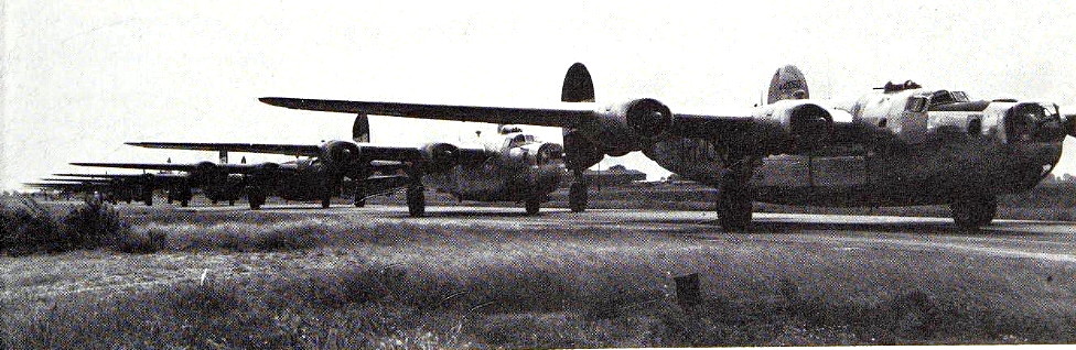
The sixteenth item shows some of 455th B-24 Liberators lining up for take-off on D-Day. The seventeenth item is a further excerpt from Jimmy Stewart Bomber Pilot. The eightheenth item is a picture from The Mighty Eighth by Roger A Freeman. The local area and area views are from my Google Earth © derived database.
NOTES:
It is exceptionally rare that after 70 years an airfield is still operating all three of the runways built in WW2 - albiet only using part of each of them.
In 1977 the following two GA aircraft were listed as being based here; the privately owned Druine D.62C Condor G-AVVN and Sheibe SF.25E Super Falke G-BDZA of the Norfolk Gliding Club.
Richard Flagg
This comment was written on: 2018-04-24 21:12:50DO you have any info about the Helipad near Priory Farm airstip? I understand it was not part of the current Priory Farm airstrip and was just south of it
We'd love to hear from you, so please scroll down to leave a comment!
Leave a comment ...
Copyright (c) UK Airfield Guide
